
- Home»
- Ads Sadiqabad»
- Services Sadiqabad»
- Other Services Sadiqabad» Civil Surveyor course in Rawalpindi
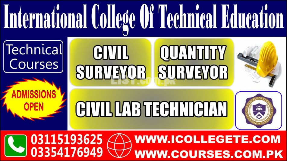
Civil Surveyor Course In Rawalpindi
Sadiqabad
City
City
Punjab
Region
Region
Civil Surveyor course in Rawalpindi Services in Pakistan
A Civil Surveyor course is a thorough education program created to provide students with the abilities and information they need to work as professionals in the land surveying industry. This course is perfect for anybody who wants to further their skills and knowledge in the subject of land surveying or who wants to pursue a career in the construction or civil engineering sectors. A wide range of topics, including surveying methods, measurements, mapping, and geospatial data processing, are covered in the curriculum. Students will gain knowledge of several surveying tools, including total stations, GPS receivers, and laser scanners, as well as how to utilize them to precisely measure and map topographic features.
The course also covers the fundamentals of land surveying, such as the ethical and legal ramifications of surveying, as well as the many approaches to land surveying, including boundary, topographic, and construction surveys. Students will learn how to utilize mapping software to make precise maps and plans as well as how to evaluate and analyze survey data. The course also includes geospatial data analysis, which entails analyzing and visualizing geographic data using cutting-edge software technologies. This contains information that may be used to produce extremely precise and in-depth maps and models of the terrain, such as information from satellite images, LiDAR, and other sources. Typically, lectures, exercises, and hands-on training with surveying tools and software are used to provide the curriculum. To obtain hands-on experience in the area, students will also have the chance to work on real-world projects including building sites and land development initiatives.
KNOWLEDGE PROFICIENCY DETAILS
On successful completion of this course, the trainee should be able to: -
1. Explain the objectives of survey and work of a surveyor.
2. Explain the principles, Classification and primary Division of Survey.
3. Define the source of errors and checking technique of surveying
instruments.
4. Define the temporary adjustment technique of instruments.
5. Describe the measurements Linear & Angular
6. Express the chain Surveying
7. Express the tackling of problems in Various Surveying Techniques.
8. Explain the use of all small/handy surveying instruments.
9. Explain the compass survey.
10. Define the solution of problems in compass survey.
11. Define the plane table survey.
12. Describe the leveling and leveling terms
13. Describe the leveling Instruments.
14. Describe the temporary adjustment of level.
15. Describe the principles of leveling
16. Explain the reduction of levels.
17. Explain the classification of leveling.
18. Explain the computation of earthwork.
19. Contouring.
20. Define the theodolite survey by traversing and triangulation.
21. Express the designing and setting out of simple/circular, transition
composes and vertical curves.
22. Express the horizontal and vertical and slop distance by tachometer.
23. Describe the equipment and procedure Photogramatery.
24. Define the total station, background and its uses.
25. Define the operations of total station and booking the fields notes.
26. Define the nature of Instrumental errors.
27. Explain the oral and writing improvement in communication skill.
Office # 27, Second Floor, Maryam Shadi Hall Plaza Airies Plaza, Shamsabad, Murree Road, Rawalpindi, Pakistan
https://www.icollegete.com/civil-surveyor-in-rawalpindi/
Civil Surveyor course in Rawalpindi services are available in Pakistan at affordable price.
Top Searches
The Truth About The Ketogenic Diet
Jang
Customer Services Rep For Good Work
58 U Block 6 P E C H S Karachi Pakistan
Abudawoodpk Sadiqabad
Https Boundlesstech Net Logo Design
Master Cool Center
Call Gir
Ilm Sadiqabad
Safli
Karigar Sadiqabad
Karachi
Tax Sadiqabad
Stamps Sadiqabad
Marriage Sadiqabad
|
|
Other Services Services Related Ads

HELPER WORKER NEEDED
Services » Other Services
Punjab, Gujranwala
Punjab, Gujranwala
02-12-2025 06:06

Diesel Engine Generators Manufacturers Exporters
Services » Other Services
Punjab, Chishtian
Punjab, Chishtian
21-11-2025 09:25

Professional SEO Courses Lahore | Learn Advanced SEO Training
Services » Other Services
Punjab, Lahore
Punjab, Lahore
19-11-2025 15:20

10L Medical Oxygen Cylinder Supplier
Services » Other Services
Punjab, Lahore
Punjab, Lahore
14-11-2025 06:45

Professional Solar Panel Cleaning Services In Karachi | Monthly & Year
Services » Other Services
Sindh, Karachi
Sindh, Karachi
10-11-2025 20:42
Safety Tips for Buyers
- Meet seller at a safe location
- Check the item before you buy
- Pay only after collecting item
Sania Rajput
Sadiqabad, Punjab, PakistanPhone No. 03115193625